
On Thursday, 21 November 2024, the South African Weather Service (SAWS) launched a pioneering rip current forecasting model designed to improve coastal safety along the Cape Peninsula's beaches.
With the festive season upon us, this new model promises to empower lifeguards, beachgoers, and emergency responders to anticipate dangerous conditions better and act swiftly to prevent accidents.
Rip currents are powerful, narrow currents of water that flow away from the shore, often catching unsuspecting swimmers. With speeds of up to 2.4 meters per second, they can be deadly, even for strong swimmers. They are responsible for a significant number of drownings annually in South Africa. In the 2017/18 and 2018/19 beach seasons, Cape Town alone recorded 30 fatal drownings, many of which were linked to rip currents.
Before this development, South Africa lacked reliable methods to predict rip current activity. The newly launched system fills this gap, offering forecasts for six key beaches along the Cape Peninsula: Blouberg, Milnerton, Fish Hoek, Monwabisi, Strand, and Kogel Bay. These beaches were selected based on their high frequency of rip current incidents during the model's development phase. However, as Lebogang Makgati, SAWS Senior Manager: Marine, pointed out, rip currents can still occur at other beaches, and the system aims to raise awareness across the coastline.
The forecasting model uses comprehensive data, including wind, wave, and tidal information, to assess the likelihood of rip currents forming. Based on real-time meteorological data, each of the six beaches is assigned a "rip risk" level, ranging from low to high. The forecast also provides specific times and locations with the highest risk, offering lifeguards and emergency teams clear, actionable insights. These predictions are delivered daily through the SAWS marine web portal. They are colour-coded to simplify communication and decision-making for beach safety personnel.
This advancement comes just in time for the summer holiday season when beaches attract an influx of visitors. The information provided by the system will help the NSRI and other rescue teams prepare by strategically positioning resources, especially on peak beach days when lifeguards may be stretched thin.
NSRI's Andrew Ingram emphasised the model's significance: "The rip current forecast model will be closely watched by all role-players involved in beach safety and will help us plan the deployment of resources over the season."
He added: "It is essential to understand that most people find it very difficult to recognise a rip current, which is why so many people get into trouble with them. The best way to avoid rips and be safe when entering the water at the beach is to visit a beach where lifeguards are on duty and go into the water between their flags."
This new forecasting system, resulting from collaboration between SAWS, Stellenbosch University, the City of Cape Town, Lifesaving South Africa, the NSRI, and international partners, is expected to reduce fatalities and enhance public awareness of rip current risks. Looking ahead, the model will be extended to include more regions, including the Eastern Cape and KwaZulu-Natal, broadening its impact across South Africa's coastlines.


Stay safe this summer: Water safety tips from the NSRI
Read More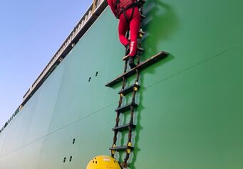
NSRI completes maritime medevac 10 nautical miles off Algoa Bay. ...
An off-duty NSRI St Lucia crew member and his brother, a former NSRI crewman, found themselves in exactly the right place at exactly the right time on Saturday, when they spotted a young girl in trouble in the shallow surf ...
Sadly, one man has died and five people survived after a boat capsized in the surf zone at Beachwood, Durban North, on Sunday evening, 19 July. NSRI Durban duty crew, alongside Police, Metro Police, Durban North Fire and Rescue Services ...